Hiking Stage Vejen-Jels (22 km)
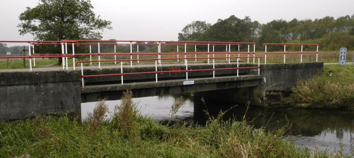
This stage offers the beautiful scenery around Kongeå River valley and the lakes at Jels. You cross the Kongeå at Frihedsbroen - the Freedom Bridge, and there are many good stories from the time when the river marked the border between Denmark and Germany. Part of the area is a nature cons
Askov
From Vejen the Military road goes westward to Askov, which is best known for its traditional high school, founded in 1865, where you are welcome to walk in the park and take in the atmosphere. The church in Askov was built in 1900, designed by the architect Rold Schrøder, who drew inspiration from early Christianity, which gives the building an unusual subdued light.
Skibelund Krat
From Askov, the route turns south to Skibelund Krat, where there is a memorial to many of the people who fought for the rights of South Jutland in the period 1864 - 1920. It has been used as a constitution day meeting place for over a hundred years. One a few km further on is the Freedom Bridge and Kongeå River. The bridge got its name during the period 1864 - 1920 when the river was the border between Denmark and Germany. At that time, the bridge was wooden and the German gendarmes had a sentry box on the south side.
Kongeåen
Many South Jutlandic people escaped to Denmark across the bridge, while others fought bitterly for their nation’s rights and identity. Among them was the local farm owner H.D. Kloppenborg in Københoved, who built a small stone house north of the bridge, and who would cross the ford towards the west, over to Denmark and wave the Danish flag at the guards, to their great irritation.
If you wish to combine your hiking on the Ancient Road (Hærvejen) with a trip along one of the other old main arteries of Jutland across the country: The Kongeå and experienxe this old river by canoe then look here.
Knagemølle
The route follows the Kongeå River in an easterly direction, through a unique nature and cultural landscape. The river is conservation area between Gredstedbro and Knagemøllen.
On the north bank of the river, is a fortification with the remains of the royal Skodborghus castle. Nowadays, the building is bisected by the highway and has had a thatched building attached to it, which was the local customs house until 1920.
On the way along the Kongeå, you will come to one of the old fords used by the Hærvej at Knagemølle, an old mill which was restored in 1960, and which is open to the public. After Knagemølle, the route returns southward past the South Jutlandic town Skodborg, which offers good shopping facilities for travellers.
Haraldsholm Skov
Immediately before Jels, the route passes through Haraldsholm Skov, which was once state woodland and is assumed to be the remains of the original Farrisskov forest which covered Denmark from Kolding to Ribe. The hurricane in 1999 caused enormous damage to the woodland and felled nearly all older trees.
Jels
In Jels, the route crosses Jels River, immediately after its origin in Jels Lakes. The town is well known for its windmill from 1859, which was used until 1971 and has since been restored and opened to the public. There is a tourist information office in the mill as well, and there is plenty of opportunity for shopping.
Another of the town’s landmarks stands in bronze on the banks of the Nedersø Lake - the Jels girl statue. There is also a outdoor swimming pool with recreational area and open-air theatre. The Orion Planetarium is located nearby.
TO THE NEXT STAGE: JELS - VOJENS